Looking back on June 8–15, 2021
We flew into Miami, picked up a rental car and immediately headed north toward Orlando. Our eventual destination was Key West, which was, of course, in the other direction.
That probably tells you something about our approach to vacation planning. If there are theme parks, national parks, historic places and interesting roads within reach, I would like to see how many we can fit into one trip.
From June 8–15, bapierson, LEGOexplorer and I gave it a try. Universal came first, then the Everglades and Biscayne, followed by the drive through the Keys. Somewhere near the end, we even managed an unplanned First-to-Find.
The rental car had a fairly full schedule.

North first: a little time at Universal
Orlando gave us a very different opening chapter from the national parks still ahead. We visited Universal Studios Florida on June 9 and Islands of Adventure on June 10. Springfield’s oversized characters and signs made a colorful contrast to what would shortly be a much quieter landscape.
The standout was Jurassic World VelociCoaster. By pure luck, our Islands of Adventure visit landed on its official opening day, June 10. The line was incredibly long, but we managed to get on.
There were a few caches around the travel days, including Platitudinous #25 Undercover at Sand Lake (GC1RCG5) on June 9. But this part of the trip was about enjoying the parks together. I can appreciate an elaborately constructed attraction just as readily as an interesting rock, even if only one of them comes with an EarthCache.
Once we had finished in Orlando, we turned the car south again.

The Everglades: look down as well as out
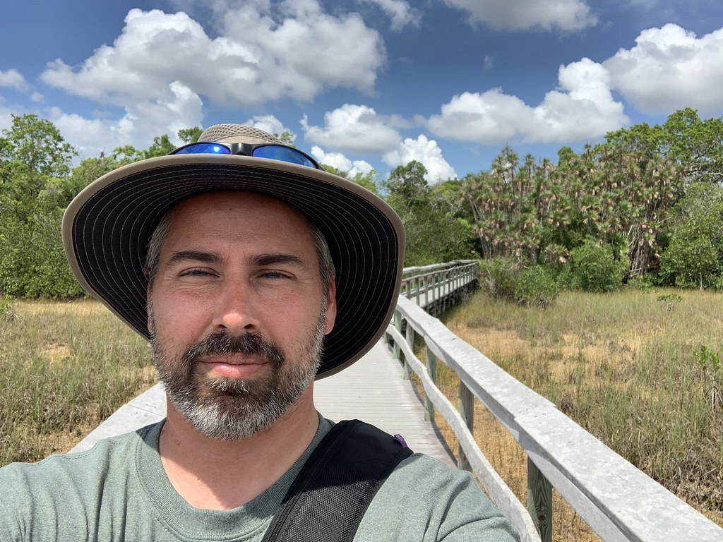
By June 11 we were exploring the Everglades. Everglades National Park North (GC7NP2T) and Wet foot, dry foot (GCHGDJ) were part of that first day in the park, followed by a fuller day of exploring on June 12.
It was hot and humid. My logs mention that more than once, which is usually a reliable sign that I was noticing it rather more often than that.
The EarthCaches helped explain what we were walking through. Bedrock of the Everglades Earthcache (GC5QHHC) focused attention on the ground beneath the wetlands, while NP Everglades - Tree Islands (GC7WG6F) highlighted the islands of vegetation rising above the surrounding landscape.
Most of the park’s bedrock is limestone. Even small changes in elevation affect how long the ground stays wet. That helps explain how patches of trees can grow above the surrounding marsh. Those two EarthCaches got me looking at what was underfoot as well as what was growing there. National Park Service geology.
One of the best moments came near Flamingo Rock Virtual (GC5694). There was construction going on, but the highlight was seeing manatees nearby. I like a good Virtual; I also know when the wildlife has stolen the show.
We added Take a Hike: Everglades NP Adventure Lab Bonus (GC96PD4), too. Between the EarthCaches, the Adventure Lab and the physical caches, there were several ways to look more closely at the park.
Biscayne: another park, another kind of water
Later on June 12 we reached Biscayne National Park. After the Everglades, it would have been easy to think we had already covered South Florida’s watery scenery. Biscayne had a different version waiting.
We stayed on shore at Convoy Point, with Biscayne Bay spreading out in front of us. About 95 percent of Biscayne National Park is water. National Park Service park overview.
We logged BISC: Biscayne National Park - Earthcache (GC32CDG) while doing the nearby Adventure Lab. We also found BISC: Convoy Point Letterbox (GC6DTP8) and Atlantis-Battle for Biscayne Bay Adventure Lab (GC99RGP), the separate Mystery bonus for the Adventure Lab. It was a busy day for a family supposedly just having a look around.
The photographs from the bay are the ones that bring me back to the vacation itself: the three of us together beside the water, rather than another total on a statistics page.

The road becomes part of the attraction
On June 13 we continued through the Keys toward Key West. Along the Overseas Highway, the bridges and stretches of open water make the drive part of the reason for going.
Flagler’s Overseas Railway reached Key West in 1912. After the 1935 Labor Day hurricane damaged the line, Florida converted surviving rail bridges for cars. By 1938, drivers could go from Miami to Key West without taking a ferry. The old bridge structures beside the highway gave us a look at the route that came before ours. Florida’s historical marker for the Old Seven Mile Bridge.
By the time we reached our hotel in Key West, we had already packed a fair bit into the vacation. Apparently, there was room for one more little adventure before check-in.

Our room was not ready. A cache was.
We had some time to kill while the hotel room was being prepared. I opened the app and noticed an available FTF nearby: Elizabeth Street Cache (GC9CN7Z).
A newly published cache, close enough to walk to, while we were waiting anyway? That seemed like unusually considerate vacation planning by the geocaching universe.
Less than a block into the walk, the sky opened up and the rain came down. Naturally. An FTF run roughly 1,200 miles from home evidently needed one more memorable detail.
We found the container quickly and in good shape. I recorded the co-FTF with bapierson and LEGOexplorer at 14:38 on June 13, signing as Team LEGOhead. Both of their logs confirm the family find, and bapierson’s confirms the FTF.
The room would eventually be ready. In the meantime, we had managed to turn a check-in delay into a very satisfying little piece of geocaching luck.

A few familiar interests at the end of the road
Key West gave us plenty to explore after that, including the Southernmost Point buoy at South and Whitehead Streets. The brightly painted landmark gave us an unmistakable family-photo stop at the end of our drive through the Keys. USA, all the way South (GC2C32) added a Virtual to the visit. After all those miles south, it seemed appropriate to have both a photograph and a smiley to show for it.

We also stopped at Sloppy Joe’s on Duval Street. The bar traces its opening to the day Prohibition ended in 1933. It moved to the corner of Duval and Greene in 1937 after Joe Russell’s landlord raised the weekly rent by a dollar. Sloppy Joe’s history.
Then A Great Mom (GCAA24) caught my attention as part of a Scouting family. LEGOexplorer had just earned Eagle Scout, so that connection was especially timely.
On June 14, I went on my own to PittPack’s Key West Sunset Meet up (GC9BV4H). I don’t go looking for events on vacation, but this one happened to be in the right place at the right time. It was fun to be the out-of-towner and spend part of our last evening talking caches with people I’d just met.
We still had one more recorded find on June 15, ORGT: Fort Zachary Taylor Historic State Park (GC55TJ9), before the trip home.
The Army began building the fort in 1845 to protect Key West Harbor. It stayed in federal hands during the Civil War and served as headquarters for the Navy’s East Gulf Coast Blockading Squadron. It originally stood offshore. Dredging in the 1960s connected it to Key West. Florida State Parks’ fort history.
We had gone north for Universal, south for the parks and farther south for the Keys. The week included wetland trails, manatees, old bridges, family photographs and a rainy dash for a brand-new cache.
A fairly roundabout way to reach the end of the road. I would call that a good use of a rental car.
Field Notes
| Detail | Trip record |
|---|---|
| Adventure | June 8–15, 2021 |
| Companions | bapierson and LEGOexplorer |
| Recorded cache finds | 57 — 55 Found it, 1 Attended, 1 Webcam Photo Taken |
| Adventure Labs | Not included in the GPX count; no verified trip-level stage total. |
| Record | Original geocaching logs and trip photographs. |
Recorded cache finds by type
My Finds GPX includes Found it, Attended and Webcam Photo Taken logs. Adventure Lab locations are recorded separately.

No comments:
Post a Comment